
LiDAR Inspection, Modeling & Analysis
for T&D Systems
Envision Geo provides expert LiDAR solutions for powerline inspection, corridor mapping, and utility infrastructure analysis.
Advanced LiDAR processing identifies conductors, towers, terrain, and vegetation, delivering precise clearances, risk detection, and reliable data for design, maintenance, and regulatory reporting.
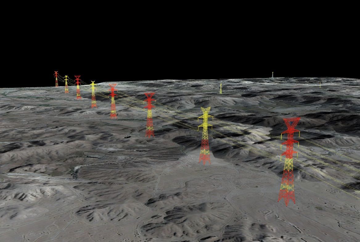
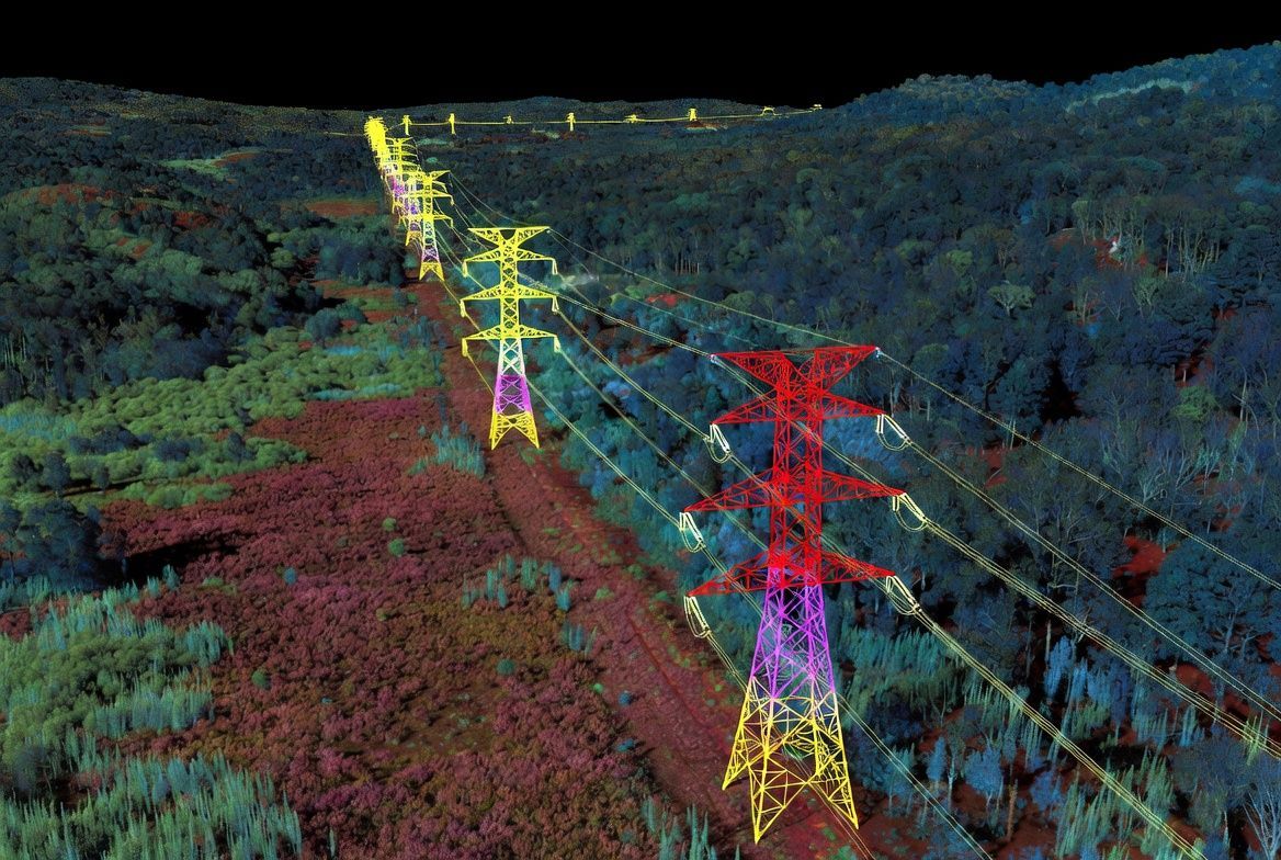
AIRBORNE LIDAR FOR CORRIDOR MAPPING
Airborne LiDAR (including drone/UAV LiDAR) efficiently maps long sections of transmission and distribution lines.
It captures terrain, conductors, structures, and surrounding features in a single high-density point cloud that is processed and classified to extract and model corridor elements such as wires, shield lines, towers, ground surface, buildings, and vegetation.
From the classified data, we generate:
- Profiles and cross section drawings
- Span measurements
- Clearance reports along the entire line
Typical Outputs include:
- Conductor and tower models
- Terrain and vegetation surfaces
- Span and structure locations
- Profile and cross-section drawings
- Clearance measurements
- Encroachment detection
- CAD and GIS data
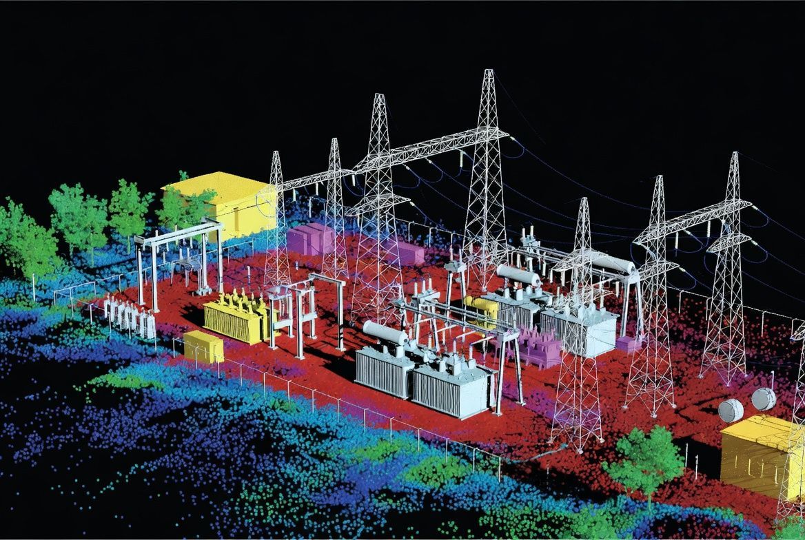
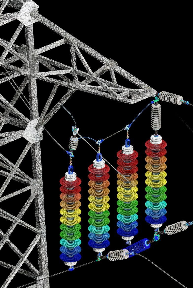
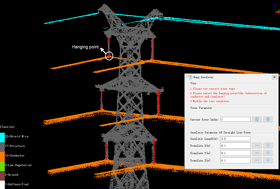
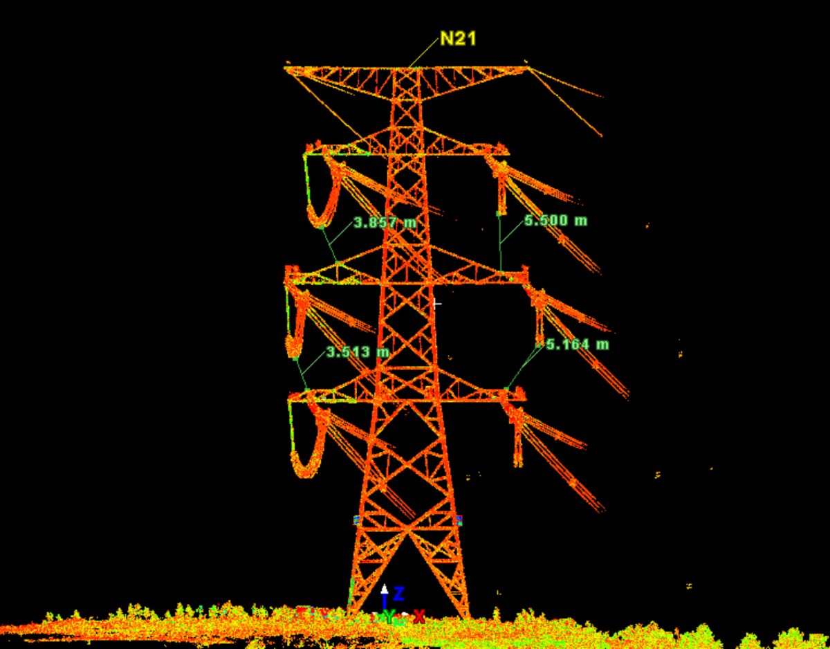
Terrestrial Lidar for towers, substation & detailed inspection
Terrestrial LiDAR (laser scanning) delivers higher detail and tighter tolerances where airborne data alone is not sufficient.
Positioned close to the asset, it produces extremely dense, high-accuracy point clouds ideal for precise component measurement.
common applications:
- Substation surveys
- Tower geometry verification
- Foundation & anchor surveys
- Retrofit and upgrade projects
- Clearance checks in congested areas
- Detailed as-built modelling
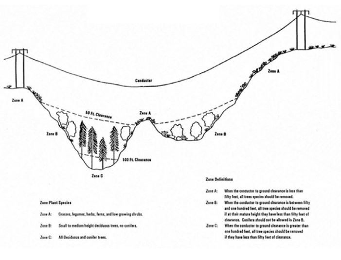
Clearance analysis and risk detection
LiDAR data enables a comprehensive analysis of conditions that could impact the safe and reliable operation of transmission and distribution systems. After classification and modelling, precise distances are calculated between conductors, terrain, vegetation, and nearby structures along the full corridor.
Typical analysis includes:
- Conductor -to-ground clearance
- Conductor-to-vegitation clearance
- Crossings with roads, rail, and other utilities
- Structure position and tilt
- Span length and sag checks
- Identification of potential contact points
- Vegetation growth and fall risk evaluation
Early identification of issues helps prevent reliability problems and safety risks.
simulation and condition modelling
LiDAR-derived models allow utilities to simulate conductor movement under varying operating and environmental conditions. By modelling span geometry and structure locations, we can predict clearance changes due to temperature, wind, or ice loading.
This supports:
- Sag and tension evaluation
- Temperature-related clearance changes
- Ice loading scenarios
- Wind deflection estimates
- Future vegetation growth projections
- Long-term maintenance planning

Inspection Planning and Reporting
LiDAR corridor models streamline inspection planning and deliver clear, actionable deliverables for engineering, maintenance,
and regulatory teams.
typical outputs include:
- Inspection maps
- Clearance and violation reports
- Structure and span tables
- Vegetation management maps
- Substation and tower models
- CAD and GIS deliverables
- Measurement reports for engineering review

